- Abbey (Barking y Dagenham)
-
Abbey Circunscripción electoral del Reino Unido 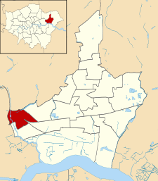
Ubicación de Abbey en Barking y Dagenham.Entidad Circunscripción electoral • País  Reino Unido
• Nación constitutiva Inglaterra • Región y condado Gran Londres • Distrito (municipio) Barking y Dagenham Concejales Laila Butt
Manzoor Hussain
Tariq SaeedSuperficie • Total 1,25 km² Población (2001) • Total 10 206 hab. • Densidad 8164,8 hab/km² Huso horario GMT (UTC0) • en verano BST (UTC +1) Prefijo telefónico 020 Abbey es una circunscripción electoral del municipio de Barking y Dagenham, en la región y el condado del Gran Londres (Inglaterra). En ella se eligen a tres de los cincuenta y un concejales que forman el Ayuntamiento de Barking y Dagenham.[1]
Contenido
Geografía
Según la Oficina Nacional de Estadística británica, Abbey tiene una superficie de 1,25 km².[2] Limita al oeste con el municipio de Newham y al norte con Redbridge, mientras que al este y al sur linda con otras tres circunscripciones de Barking y Dagenham: Longbridge, Eastbury y Gascoigne.
Demografía
Según el censo de 2001,[2] Abbey tenía 10 206 habitantes (50,38% varones, 49,62% mujeres) y una densidad de población de 8164,8 hab/km². El 24,65% eran menores de 16 años, el 71,48% tenían entre 16 y 74, y el 3,87% eran mayores de 74. La media de edad era de 31,73 años.
Según su grupo étnico, el 54,36% de los habitantes eran blancos, el 3,2% mestizos, el 26,05% asiáticos, el 14,28% negros, el 0,73% chinos, y el 1,37% de cualquier otro. La mayor parte (67,59%) eran originarios del Reino Unido. El resto de países europeos englobaban al 5,94% de la población, mientras que el 8,03% había nacido en África, el 15,59% en Asia, el 1,75% en América del Norte, el 0,32% en América del Sur, el 0,3% en Oceanía, y el 0,47% en cualquier otro lugar. El cristianismo era profesado por el 49,89%, el budismo por el 0,66%, el hinduismo por el 3,88%, el judaísmo por el 0,37%, el islam por el 21,07%, el sijismo por el 4,97%, y cualquier otra religión por el 0,34%. El 10,93% no eran religiosos y el 7,88% no marcaron ninguna opción en el censo.
El 54,34% de los habitantes estaban solteros, el 32,25% casados, el 3,17% separados, el 6,24% divorciados y el 4% viudos. Había 4090 hogares con residentes, de los cuales el 35,72% estaban habitados por una sola persona, el 15,62% por padres solteros con o sin hijos dependientes, el 44,25% por parejas (36,48% casadas, 7,77% sin casar) con o sin hijos dependientes, y el 4,4% por múltiples personas. Además, había 38 hogares sin ocupar y 9 eran alojamientos vacacionales o segundas residencias.
La población económicamente activa se situó en 4631 habitantes, de los que un 83,89% tenían empleo, un 9,7% estaban desempleados, y un 6,41% eran estudiantes a tiempo completo.
Referencias
- ↑ «Wards and councillors» (en inglés). Ayuntamiento de Barking y Dagenham. Consultado el 11 de agosto de 2011.
- ↑ a b «Area: Abbey (Ward)» (en inglés). Office for National Statistics. Consultado el 11 de agosto de 2011.
Enlaces externos
Categoría:- Circunscripciones electorales de Barking y Dagenham

Wikimedia foundation. 2010.