- Itaju do Colônia
-
Itaju do Colônia 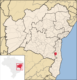
MapaCoordenadas: Coordenadas: Entidad Municipio • País  Brasil
• Estado Bahia • Mesorregión Sul Baiano • Microrregión Ilhéus-Itabuna Prefecto Edinaldo Superficie • Total 1,217.535 km² Población (est. IBGE/2009[1] ) • Total 7,706 hab. • Densidad 6,3 hab/km² PIB (nominal) • Total 25.482 mil • PIB per cápita 3.253,00 Huso horario -3 Datos mesorregión IBGE/2008[2] Datos microrregión IBGE/2008[2] Itaju do Colônia es un municipio brasileño del estado de la Bahia.
Historia
Geografía
Su población estimada en 2004 era de 7.968 habitantes.
Referencias
- ↑ «Estimativas da população para 1º de julho de 2009» (PDF). Estimativas de População. Instituto Brasileiro de Geografia e Estatística (IBGE) (14 de agosto de 2009). Consultado el 16 de agosto de 2009.
- ↑ a b «Divisão Territorial do Brasil». Divisão Territorial do Brasil e Limites Territoriais. Instituto Brasileiro de Geografia e Estatística (IBGE) (1 de julho de 2008). Consultado el 11 de octubre de 2008.
- Este artículo fue creado a partir de la traducción total del artículo [[pt:|]] de la Wikipedia en portugués, concretamente de Plantilla:Localurl: esta versión, bajo licencia Creative Commons Atribución Compartir Igual 3.0 y GFDL.
Categoría:- Localidades de Bahía

Wikimedia foundation. 2010.