- Itanagra
-
Itanagra Otros nombres: Itanagra 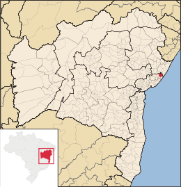
MapaCoordenadas: Coordenadas: Entidad Municipio • País  Brasil
• Estado Bahía • Mesorregión Metropolitana de Salvador • Microrregión Catu Fundación 30 de julio • Fundación 30 de julio de 1962 Superficie • Total 452,375 km²[1] Clima Tropical Población (IBGE/2010[2] ) • Total 7.591 hab. • Densidad 16,78 hab/km² Gentilicio itanagrense PIB (nominal) • Total 31.399,120 mil • PIB per cápita 4589.84 IDH (PNUD/2000[3] ) 0.603 Datos mesorregión IBGE/2008[4] Datos microrregión IBGE/2008[4] Municipios vecinos Araçás (norte e oeste), Entre Rios (norte), Mata de São João (sul e oeste), Pojuca (oeste) Dist. Cap. 91 Km Itanagra es un municipio brasileño del estado de Bahía. Fue fundado el día 30 de julio de 1962.
El nombre Itanagra significa Piedra de Arena.
Su población estimada en 2004 era de 6.789 habitantes.
Referencias
- ↑ . Resolução da Presidência do IBGE de n° 5 (R.PR-5/02) (10 out. 2002). Consultado el 5 diez. 2010.
- ↑ . Instituto Brasileiro de Geografia e Estatística (IBGE) (29 de noviembre de 2010). Consultado el 11 de diciembre de 2010.
- ↑ «Ranking decreciente del IDH-M de los municipios del Brasil». Programa das Nações Unidas para o Desenvolvimento (PNUD) (2000). Consultado el 11 de octubre de 2008.
- ↑ a b «División Territorial del Brasil». Instituto Brasileiro de Geografia e Estatística (IBGE) (1 de julio de 2008). Consultado el 11 de octubre de 2008.
- Este artículo fue creado a partir de la traducción automática del artículo Itanagra de la Wikipedia en portugués, concretamente de esta versión, bajo licencia Creative Commons Atribución Compartir Igual 3.0 y GFDL.
Categoría:- Localidades de Bahía

Wikimedia foundation. 2010.