- Johnston (Rhode Island)
-
Johnston Pueblo de los Estados Unidos Ubicación en el condado de Providence y en el estado de Rhode Island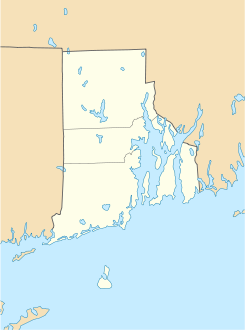
 Johnston
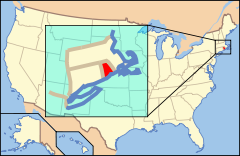
Ubicación de Rhode Island en EE. UU.Coordenadas: Entidad Pueblo • País  Estados Unidos
• Estado  Rhode Island
• Condado Providence Fundación 6 de marzo de 1759 Superficie • Total 63,1 km² • Tierra 61,3 km² • Agua (2,91%) 1,8 km² Altitud • Media 97 msnm Población (2000) • Total 28.195 hab. • Densidad 460 hab/km² Huso horario Este: UTC-5 • en verano UTC-4 Código postal 02919 Prefijo telefónico 401 Sitio web oficial Johnston es un pueblo ubicado en el condado de Providence en el estado estadounidense de Rhode Island. En el año 2000 tenía una población de 28,195 habitantes y una densidad poblacional de 460 personas por km².
Contenido
Geografía
Johnston se encuentra ubicado en las coordenadas Coordenadas: . Según la Oficina del Censo, la ciudad tiene un área total de 63,1 km² (24,4 mi²), de la cual 61,3 km² (23,7 mi²) es tierra y 1,8 km² (0,7 mi²) (2.91%) es agua.
Demografía
Según la Oficina del Censo en 2000 los ingresos medios por hogar en la localidad eran de $43,514, y los ingresos medios por familia eran $54,837. Los hombres tenían unos ingresos medios de $40,210 frente a los $29,314 para las mujeres. La renta per cápita para la localidad era de $21,440. Alrededor del 8.3% de la población estaban por debajo del umbral de pobreza.[1]
Referencias
- ↑ «U.S. Gazetteer: Censo de 2010» (en inglés). Oficina del Censo de los Estados Unidos (16 de febrero de 2011). Consultado el 11 de julio de 2011.
Enlaces externos
 Portal:Rhode Island. Contenido relacionado con Rhode Island.
 Wikimedia Commons alberga contenido multimedia sobre Johnston (Rhode Island). Commons
Categorías:- Localidades del condado de Providence
- Localidades de Rhode Island
- Johnston (Rhode Island)


Wikimedia foundation. 2010.