- Letocetum
-
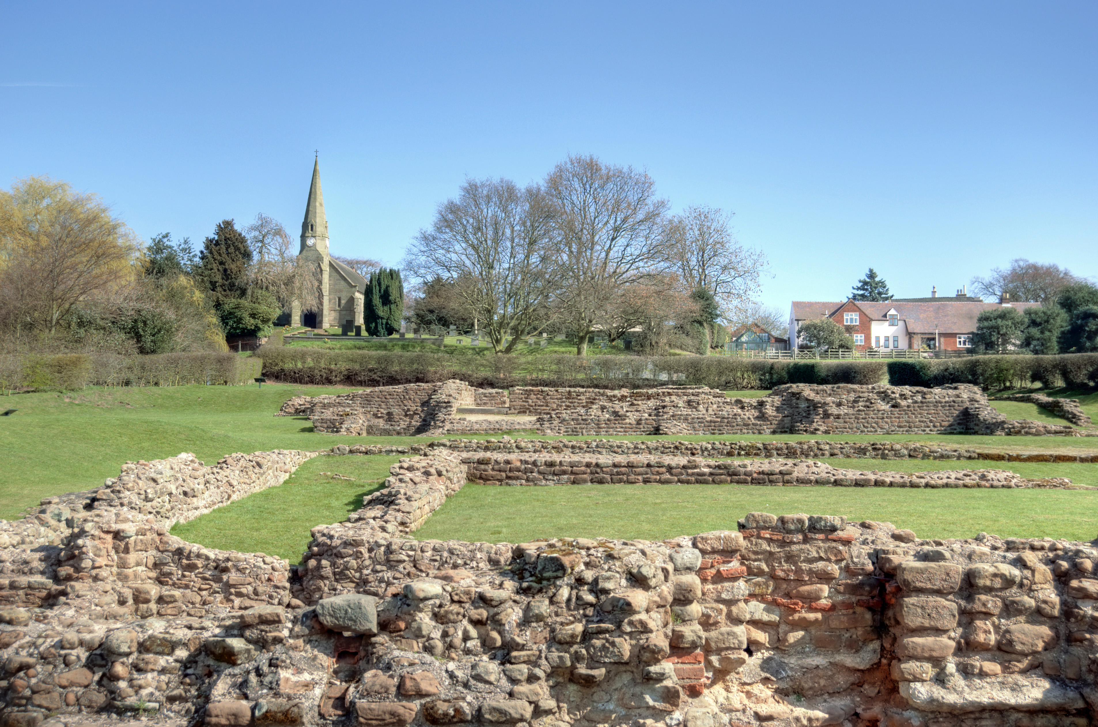
 Restos de Letocetum.
Letocetum es un yacimiento arqueológico de un antiguo asentamiento romano, ubicado en la parroquia de Wall, Staffordshire, en Inglaterra. Fue un importante puesto militar y parada cerca de la unión de Watling Street, la vía militar romana a Gales del Norte (actual vía A5) y Icknield Street (actual vía A38). La Fundación Nacional para Lugares de Interés Histórico o Belleza Natural es la propietaria y administradora del sitio bajo el nombre de Letocetum Roman Baths Site & Museum. Asimismo, se encuentra bajo la tutela del English Heritage como Wall Roman Site.
Los romanos llegaron a Letocetum en el año 50 para establecer una fortaleza durante los primeros años de la invasión de Britania. La tierra no podía sostener a grandes cantidades de soldados y Letocetum, en un importante cruce de caminos, se convirtió en una estación de gran escala. El asentamiento se desarrolló junto con sucesivas casas de baño y mansiones construidas para servir tanto a los viajeros oficiales como a la creciente población civil. Es conocido principalmente por excavaciones detalladas llevadas a cabo en 1912 y 1913, las cuales se concentraron en los sitios de la mansio y la casa de baño, aunque existe evidencia de un asentamiento sustancial con una posible basílica, templos y un anfiteatro.
Los restos visibles son aquellos de la casa de baño y la mansio de piedra, construidas aproximadamente en el año 130, después de que Letocetum dejara de tener una función militar y se convirtiera en un asentamiento civil. El asentamiento llegó a su apogeo durante los siglos II y III y, en esta época, ocupó 8,1-12 hectáreas (20–30 acres). A fines del siglo III, la población fue reubicada al interior de altos muros defensivos a lo largo de Watling Street. Cuando los romanos se marcharon a inicios del siglo V, el asentamiento cayó en declive. La localidad moderna de Wall surgió en el terreno una vez ocupada por Letocetum.
Contenido
Etimología
El sitio es mencionado como "Etocetum" en el Itinerario de Antonino y es interpretado como la versión latinizada del británico "Letoceton"; leto — gris, ceton — área arbolada. Literalmente, significa área arbolada gris o bosque gris, que puede referirse a los olmos y fresnos nativos que habrían cubierto la tierra en esa época..[1] Posteriormente, aparece en galés cuando el sitio o la cercana Lichfield son denominados "Caer Lwytgoed" (en galés moderno: llwyd — gris, coed — madera).[2]
Referencias
- ↑ Gould 1998, p. 6.
- ↑ «LETOCETVM Roman Forts and Camps. Romano-British Fortified Town». www.Roman-Britain.org (28 de septiembre de 2010). Consultado el 17 de junio de 2011.
Bibliografía
- Gould, Jim (1998). Letocetum: The Rise and Decline of a Roman Posting Station. J. Gould. ISBN 0953490505.
- Greenslade, M.W. (1990). A History of the County of Stafford: Volume XIV. Victoria County History. ISBN 978 0197227787.
- Reno, Frank (1999). Historic Figures of the Arthurian Era. Mc Farland & Co. ISBN 978 0786406487.
Enlaces externos
 Wikimedia Commons alberga contenido multimedia sobre Letocetum. Commons
- Letocetum Roman Baths Site & Museum information at the National Trust
- Wall Roman Site (Letocetum) information at English Heritage
Coordenadas:
Categorías:- Yacimientos arqueológicos del Reino Unido
- Atracciones turísticas del Reino Unido
- Staffordshire
- Zonas protegidas de Inglaterra
- Ciudades romanas en Reino Unido
- Museos de Inglaterra
Wikimedia foundation. 2010.