- Ohatchee (Alabama)
-
Ohatchee Pueblo de los Estados Unidos 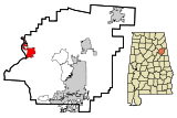
Ubicación en el condado de Calhoun y en el estado de Alabama
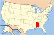
Ubicación de Alabama en EE. UU.Entidad Pueblo • País  Estados Unidos
• Estado  Alabama
• Condado Calhoun Superficie • Total 15,7 km² • Tierra 15,6 km² • Agua 0,1 km² Altitud • Media 155 msnm Población (2010) • Total 1.170 hab. • Densidad 74,52 hab/km² Huso horario Centro: UTC-6 • en verano UTC-5 Código ZIP 36271 Código de área 256 Ohatchee es un pueblo ubicado en el condado de Calhoun en el estado estadounidense de Alabama. En el censo de 2000, su población era de 1.215.
Contenido
Demografía
En el 2000[1] la renta per cápita promedia del hogar era de $ 38.359$, y el ingreso promedio para una familia era de 42.891$. El ingreso per cápita para la localidad era de 19.032$. Los hombres tenían un ingreso per cápita de 34.625$ contra 24.659$ para las mujeres.
Geografía
Ohatchee está situado en (33.803040, -86.036629)[2] .
Según la Oficina del Censo de los EE.UU., la ciudad tiene un área total de 6.03 millas cuadradas (15.61 km²).
Referencias
- ↑ «American FactFinder» (en inglés). Oficina del Censo de los Estados Unidos. Consultado el 11 de julio de 2011.
- ↑ «U.S. Gazetteer: Censo de 2010» (en inglés). Oficina del Censo de los Estados Unidos (16 de febrero de 2011). Consultado el 11 de julio de 2011.
Enlaces externos
 Portal:Alabama. Contenido relacionado con Alabama.
Categorías:- Localidades del condado de Calhoun (Alabama)
- Pueblos de Alabama


Wikimedia foundation. 2010.