- Olivenhain (California)
-
Olivenhain Comunidad de los Estados Unidos 
Vista de Olivenhain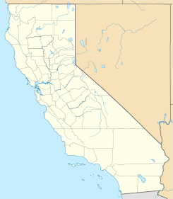
 Olivenhain
Mapa de OlivenhainCoordenadas: Entidad Comunidad • País  Estados Unidos
• Estado  California
• Condado San Diego Fundación 21 de mayo de 1884 Superficie Huso horario Pacífico: UTC-8/-7 Código postal 92024 Sitio web oficial 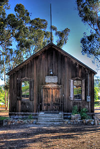 Salón de Reuniones
Olivenhain es una comunidad rural de cinco comunidades de Encinitas del condado de San Diego en el estado estadounidense de California. La localidad se encuentra ubicada al oeste de Rancho Santa Fe.[1] La comunidad empezó a poblarse a inicios de 1884 por un grupo de alemanes. Debido a su baja densidad, la comunidad tiene alrededor de 1500 viviendas.
Referencias
- ↑ «U.S. Gazetteer: Censo de 2010» (en inglés). Oficina del Censo de los Estados Unidos (16 de febrero de 2011). Consultado el 11 de julio de 2011.
Enlaces externos
 Portal:San Diego. Contenido relacionado con San Diego.
- Página oficial
- Distrito Municipal del Agua de Olivenhain
 Wikimedia Commons alberga contenido multimedia sobre Olivenhain (California). Commons
Categorías:- Áreas no incorporadas de California
- Localidades del condado de San Diego


Wikimedia foundation. 2010.