- Oysterville (Washington)
-
Oysterville Área no incorporada de los Estados Unidos Ubicación en el condado de Pacific en el estado de Washington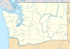
 Oysterville
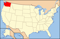
Ubicación de Washington en EE. UU.Coordenadas: Entidad Área no incorporada • País  Estados Unidos
• Estado  Washington
• Condado Pacific Huso horario Pacífico: UTC-8 • en verano UTC-7 Oysterville es un área no incorporada ubicada en el condado de Pacific en el estado estadounidense de Washington.
Geografía
Oysterville se encuentra ubicado en las coordenadas Coordenadas: .[1]
Referencias
- ↑ «American FactFinder» (en inglés). Oficina del Censo de los Estados Unidos. Consultado el 11 de julio de 2011.
Enlaces externos
 Portal:Washington. Contenido relacionado con Washington.
 Wikimedia Commons alberga contenido multimedia sobre Oysterville (Washington). Commons
Categorías:- Áreas no incorporadas de Washington
- Localidades de Washington
- Localidades del condado de Pacific (Washington)


Wikimedia foundation. 2010.