Sekiu, Washington — Infobox Settlement name =Sekiu official name = other name = native name = nickname = settlement type =Unincorporated Community total type = motto = imagesize = image caption = Fishing boats out for the winter in Sekiu. flag size = image seal size … Wikipedia
Sekiu River — Infobox River river name = Sekiu River image size = caption = origin = mouth = coord|48|17|17.2|N|124|23|40.4|W basin countries = United States length mi = 12.5 length = elevation ft = elevation = mouth elevation ft = 6 mouth elevation =… … Wikipedia
Sekiu Airport — is a public airport serving the small community of Sekiu, in Clallam County, Washington, United States. It is owned by the Port of Port Angeles. Facilities and aircraft Sekiu Airport covers an area of 25 acres (10 ha) which contains a 2,997 x 50… … Wikipedia
Washington State Route 112 — Infobox WA State Route|route=112|sec=215|length mi=61.29 length ref=cite web|author=Washington State Department of Transportation|url=http://www.wsdot.wa.gov/mapsdata/tdo/PDF and ZIP Files/HwyLog2005B.pdf|title=State Highway Log, 2005… … Wikipedia
Washington State Route 113 — Infobox WA State Route|parent type=U.S.|parent=101|sec=216|length mi=9.98 length ref= [http://www.wsdot.wa.gov/mapsdata/tdo/PDF and ZIP Files/HwyLog2005B.pdf State Highway Log] , Washington State Department of Transportation, 2005 B] length round … Wikipedia
National Register of Historic Places listings in Clallam County, Washington — List of National Registered Historic Places in Clallam County, Washington See also List of Registered Historic Places in Washington This National Park Service list is complete through NPS recent listings posted November 10, 2011.[1] … Wikipedia
Clallam Bay, Washington — Clallam Bay Unincorporated community The mouth of the Clallam River is located in Clallam Bay County Park … Wikipedia
Clallam County, Washington — Seal … Wikipedia
List of unincorporated communities in Clallam County, Washington — The following list details communities in Clallam County, Washington, that are not recognised as incorporated by the U.S. Census as of 2006. This may include disincorporated communities, towns with no incorporated status, ghost towns, or… … Wikipedia
Forks, Washington — Infobox Settlement official name = Forks, Washington settlement type = City nickname = Logging Capital of the World website = [http://www.forkswashington.org/ www.forkswashington.org] imagesize = image caption = mapsize = 250px map caption =… … Wikipedia
 Sekiu
Sekiu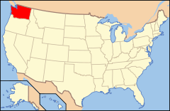
 Estados Unidos
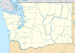
 Washington
 Portal:Washington. Contenido relacionado con Washington.
 Wikimedia Commons alberga contenido multimedia sobre Sekiu (Washington). Commons
