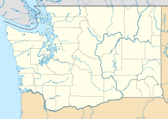
Southworth, Washington — Southworth is an unincorporated community on Puget Sound in Kitsap County, Washington, United States. Located at coord|47|30|44|N|122|30|02|W|,GR|3 it is best known for being the west end of the Fauntleroy Vashon Island Southworth Washington… … Wikipedia
Southworth — Places= * Southworth, Washington unincorporated community on Puget Sound in Kitsap County, Washington. * Point Southworth on Kitsap Peninsula on the western side of the northern entrance to Colvos Passage in Puget Sound.People* E. D. E. N.… … Wikipedia
Southworth House (Cleveland, Ohio) — Southworth House U.S. National Register of Historic Places … Wikipedia
Southworth, Emma — ▪ American author née Emma Dorothy Eliza Nevitte, also called Mrs. E.d.e.n. Southworth born Dec. 26, 1819, Washington, D.C., U.S. died June 30, 1899, Georgetown, Washington, D.C. one of the most popular of the 19th century American… … Universalium
Washington State Route 160 — Infobox WA State Route|parent type=SR|parent=16|route=160|sec=305|length mi=7.47 [http://www.angelfire.com/wa2/hwysofwastate/sr160.html State Route 160 ] ] |length km=12.01|length notes=Mileage does not include ferry|type=State… … Wikipedia
Washington State Ferries — This page is about the ferry system operated by the state of Washington. Other entities operate other Ferries in Washington State Washington State Ferries is a passenger and automobile ferry service owned and operated by the Washington State… … Wikipedia
Washington State Route 339 — Karte … Deutsch Wikipedia
Washington State Route 339 — Infobox road state=WA type=SR route=339 alternate name=Seattle / Vashon Island PO ferry maint= direction a=West terminus a=jct|state=WA|SR|160|city1=Vashon Heights ferry terminal direction b=East terminus b=jct|state=WA|SR|519|city1=Seattle Pier… … Wikipedia
Washington State Route 16 — Karte … Deutsch Wikipedia
Point Southworth — lies on Kitsap Peninsula on the western side of the northern entrance to Colvos Passage in Puget Sound. The point is high and wooded.A Washington State Ferries dock is about 0.2 miles northwest of Point Southworth, in the community of Southworth … Wikipedia
 Southworth
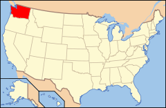
 Estados Unidos
 Washington
 Portal:Washington. Contenido relacionado con Washington.
 Wikimedia Commons alberga contenido multimedia sobre Southworth (Washington). Commons
