Tring Rural

Tring Rural
Tring Rural
Parroquia civil del Reino Unido
Tring Rural
Tring Rural
Ubicación de Tring Rural en Hertfordshire.
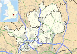
51°49′40″N 0°41′59.8″O / 51.82778, -0.699944Coordenadas: 51°49′40″N 0°41′59.8″O / 51.82778, -0.699944
Entidad Parroquia civil
 • País Bandera del Reino Unido Reino Unido
 • Nación constitutiva Inglaterra
 • Región Este de Inglaterra
 • Condado Hertfordshire
 • Distrito Dacorum
Superficie  
 • Total 17,72 km²
Población (2001)  
 • Total 1.292 hab.
 • Densidad 72,91 hab/km²
Huso horario GMT (UTC0)
 • en verano BST (UTC +1)

Tring Rural es una parroquia civil del distrito de Dacorum, en el condado de Hertfordshire (Inglaterra).

Geografía

Según la Oficina Nacional de Estadística británica, Tring Rural tiene una superficie de 17,72 km².[1]

Demografía

Según el censo de 2001, Tring Rural tenía 1292 habitantes (50,31% varones, 49,69% mujeres) y una densidad de población de 72,91 hab/km². El 23,07% eran menores de 16 años, el 72,29% tenían entre 16 y 74, y el 4,64% eran mayores de 74. La media de edad era de 37,39 años. Del total de habitantes con 16 o más años, el 21,23% estaban solteros, el 66,2% casados, y el 12,58% divorciados o viudos.[2]

El 95,59% de los habitantes eran originarios del Reino Unido. El resto de países europeos englobaban al 1,63% de la población, mientras que el 2,79% había nacido en cualquier otro lugar. Según su grupo étnico, el 99,23% eran blancos, el 0,54% mestizos, y el 0,23% asiáticos. El cristianismo era profesado por el 75,1%, el judaísmo por el 0,78%, el islam por el 0,39%, y el sijismo por el 0,23%. El 17,07% no eran religiosos y el 6,44% no marcaron ninguna opción en el censo.[1]

Había 520 hogares con residentes, 5 vacíos, y 5 eran alojamientos vacacionales o segundas residencias.[2]

Referencias

  1. a b Tablas: «Usual Resident Population (KS01) for Amalgamated Parishes», «Ethnic Group (KS06) for Amalgamated Parishes», «Country of Birth (KS05) for Amalgamated Parishes» y «Religion (KS07) for Amalgamated Parishes», disponibles para descarga aquí. Office for National Statistics (inglés).
  2. a b «Area: Tring Rural CP (Parish)» (en inglés). Office for National Statistics. Consultado el 26 de octubre de 2011.

Wikimedia foundation. 2010.

Игры ⚽ Поможем написать курсовую

Mira otros diccionarios:

  • Tring Rural — is a Civil Parish in Hertfordshire, England. It is composed of the villages of Long Marston, Wilstone, Puttenham, and the hamlets of Gubblecote and Astrope. It is largely situated the north of the town of Tring. Tring itself is not part of the… …   Wikipedia

  • List of civil parishes in Hertfordshire — This is a list of civil parishes in Hertfordshire, England.Broxbourne none DacorumHemel Hempstead is unparished.* Aldbury * Berkhamsted * Bovingdon * Chipperfield * Flamstead * Flaunden * Great Gaddesden * Kings Langley * Little Gaddesden *… …   Wikipedia

  • Puttenham, Hertfordshire — infobox UK place country = England latitude=51.82298 longitude= 0.71298 official name= Puttenham population= shire district= Dacorum shire county = Hertfordshire region= East of England constituency westminster= South West Hertfordshire post town …   Wikipedia

  • Long Marston, Hertfordshire — infobox UK place country = England latitude=51.83089 longitude= 0.69593 official name= Long Marston population= shire district= Dacorum shire county = Hertfordshire region= East of England constituency westminster= South West Hertfordshire post… …   Wikipedia

  • Wilstone — infobox UK place country = England latitude=51.8177 longitude= 0.68885 official name= Wilstone population= shire county = Hertfordshire region= East of England post town= Tring postcode district = HP23 postcode area= HP os grid reference=… …   Wikipedia

  • Dacorum Council election, 2011 — Dacorum Borough Council election, 2011 2007 ← 5 May 2011 (2011 05 05) …   Wikipedia

  • Dacorum — Not to be confused with Decorum. Borough of Dacorum   Borough, Non metropolitan district   A street in Hemel Hempstead, a town in Daco …   Wikipedia

  • List of museums in England — Museums in England is a link page for any museum in England by ceremonial county. The Museums, Libraries and Archives Council is the national development agency for museums in England, and is a sponsored body of the Department for Culture, Media… …   Wikipedia

  • Cholesbury — Coordinates: 51°45′17″N 0°39′08″W / 51.7546°N 0.6521°W / 51.7546; 0.6521 …   Wikipedia

  • Parliamentary constituencies in Hertfordshire — The county of Hertfordshire in relation to England The county of Hertfordshire in England is divided into eleven Parliamentary constituencies. Each of the eleven elects a Member of Parliament (MP) to represent it at the United K …   Wikipedia

Compartir el artículo y extractos

Link directo
Do a right-click on the link above
and select “Copy Link”