Castletown, Dorset — Castletown is a small village in Underhill on the Isle of Portland in Dorset. It has a sandy beach and has a working port, Portland Port. The village itself is on the shores of Portland Harbour, and includes Portland Castle and the Weymouth and… … Wikipedia
Castletown (disambiguation) — Castletown is the former capital of Isle of Man.Castletown may also mean the following places:in England: *Castletown, Portland, Dorset *Castletown, Tyne and Wear *Castletown, Penrith, Cumbriain the Republic of Ireland: *Castletown, County Cork,… … Wikipedia
Castletown — Saltar a navegación, búsqueda Castletown puede referirse a: Castletown, una pequeña localidad en la isla de Pórtland, condado de Dorset, Inglaterra. Castletown House, la casa de campo más grande de Irlanda, ubicada en Celbridge, condado de… … Wikipedia Español
List of places in Dorset — This is a list of settlements and other places in Dorset, England. Settlements with a population over 3,000 are in bold. For a list of districts see the main Dorset article. See List of places in England for settlements in other… … Wikipedia
Underhill, Dorset — Location map Dorset lat=50.549 long= 2.43600 width=180 float=right caption= Underhill shown within Dorset (gbmapping|SY692723)Underhill is the name given to the area of land at the northern end of the Isle of Portland in Dorset, England, which is … Wikipedia
Villages of Portland — For Portland as a single community, see Isle of Portland The Isle of Portland, Dorset, contains eight settlements, the largest being Fortuneswell in Underhill and Easton in Tophill. Castletown and Chiswell are the other villages in Underhill, and … Wikipedia
Isle of Portland — infobox UK place country = England official name= Isle of Portland map type = Dorset latitude= 50.550 longitude= 2.440 population = 12,710cite web| year = 2005 | url = http://www.dorsetforyou.com/index.jsp?articleid=343603 | title=Portland… … Wikipedia
Isla de Pórtland — Isle of Portland Isla de Pórtland … Wikipedia Español
Portland Branch Railway — The Portland Branch railway was a railway line located on the Isle of Portland, a peninsula in the English county of Dorset. The line operated from the late nineteenth century until closing to passengers in 1952 and goods in 1965. For a short… … Wikipedia
Fortuneswell — infobox UK place country = England static static image caption = latitude = 50.55836 longitude = 2.43968 official name = Fortuneswell population = shire district= Weymouth and Portland shire county = Dorset region = South West England… … Wikipedia
 Castletown y el Puerto de Pórtland vistos desde The Verne. La Academia Nacional de Navegación y el Castillo de Pórtland están en la izquierda. Los edificios de primer plano son antiguos edificios navales, ahora convertidos en departamentos lujosos.
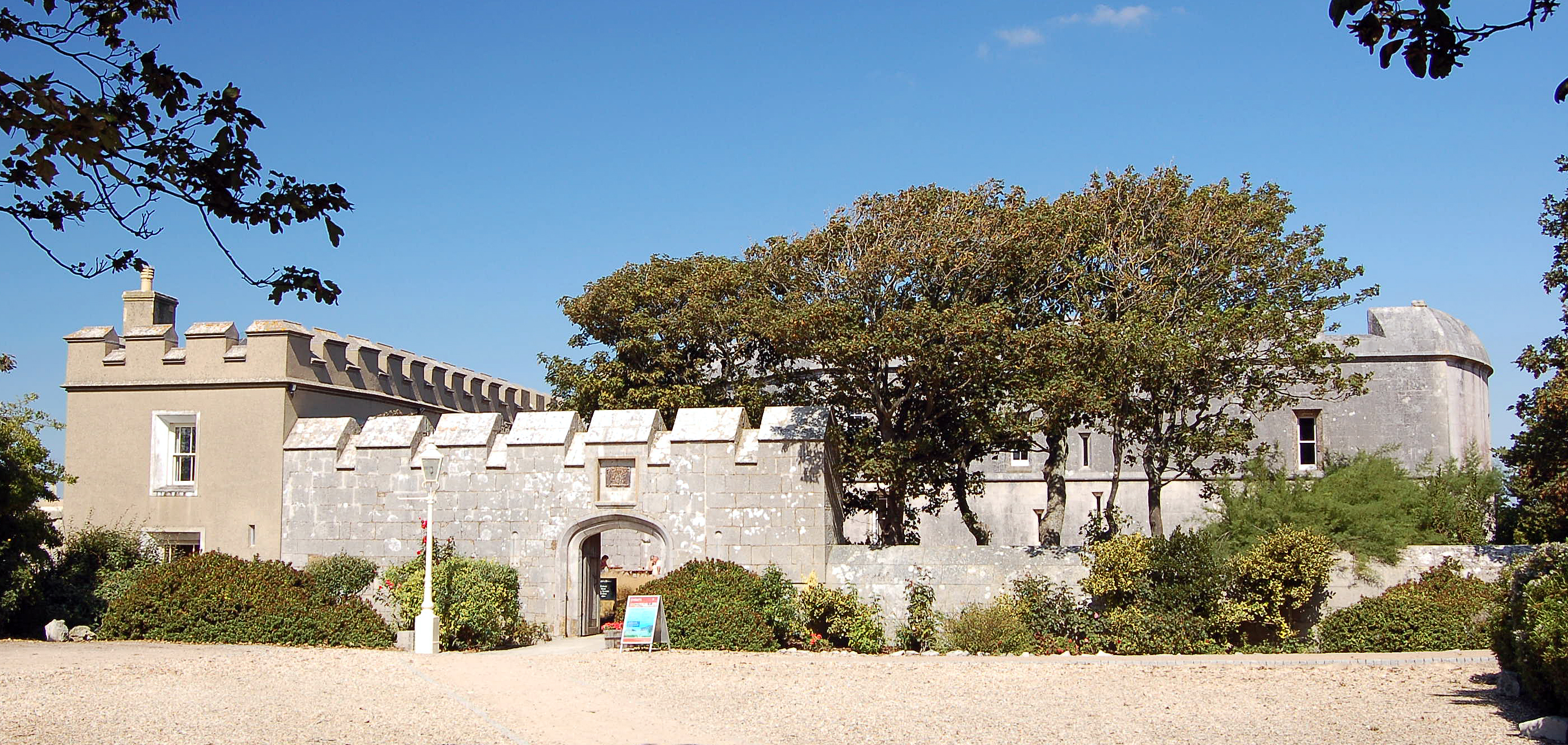
 Entrada del Castillo de Pórtland.