Aishalton

Aishalton
Aishalton
Aishalton
Aishalton
Localización de Aishalton
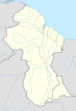
País Bandera de Guyana Guyana
• Región Alto Takutu-Alto Essequibo
Ubicación 2°31′N 59°15′O / 2.517, -59.25Coordenadas: 2°31′N 59°15′O / 2.517, -59.25
• Latitud 3° 23′ N
• Longitud 59° 48′ O
• Altitud 180 msnm
• Distancia 96 km a Lethem
Población 1178 hab.
inglés
Huso horario UTC-4
Village 54

Aishalton es una localidad de Guyana en la región Alto Takutu-Alto Essequibo

La población está constituída mayomente por indígenas de la etnia Wapishana.

Se ubica aproximadamente a 96 km al sureste de Lethem. Posee escuelas secundarias y primarias. El servicio nacional de bibliotecas estableció una biblioteca en Aishalton en 1976. En la década de 1980 se construyó un hospital con la ayuda de los Países Bajos.

El servicio del Internet existe donado por una compañía de explotación minera canadiense con intereses en el área.


Demografía

Según censo de población 2002 contaba con 578 habitantes.

Ocupación de la población[1]

Dato Funcionarios Profesionales
y técnicos
Clero Comercio y
Servicios
Act. agrícolas Act. industriales Ocup.
elementales
S/D Total
Poblacion 11 29 3 58 290 13 23 153 578

Referencias

  1. Datos del censo 2002. Localidad 54

Wikimedia foundation. 2010.

Игры ⚽ Нужна курсовая?

Mira otros diccionarios:

  • Aishalton — Infobox Settlement official name = Aishalton other name = native name = nickname = settlement type = motto = imagesize = image caption = flag size = image seal size = image shield = shield size = image blank emblem = blank emblem type = blank… …   Wikipedia

  • AHL — is a three letter abbreviation with multiple meanings, as described below:* American Hockey League, professional ice hockey league in the USA and Canada * Australian Hockey League, Australian national field hockey league * Allianz Hurling League… …   Wikipedia

  • Cheddi Jagan International Airport — IATA: GEO – ICAO: SYCJ …   Wikipedia

  • Ogle Airport — (IATA: OGL, ICAO: SYGO) is located on the Atlantic Ocean coast of Guyana, 6 miles east of the capital, Georgetown. In 2003 the airport was a local hub shuttling some 50,000 passengers and 1,800 tons of cargo annually. Construction began that …   Wikipedia

  • Liste der IATA-Codes/A — Diese Teilliste führt alle IATA Flughafen Codes auf, die mit „A“ beginnen, und enthält Informationen zu den bezeichneten Verkehrsknotenpunkten. IATA Codes   A B C D E F G H I J K L M N O P Q …   Deutsch Wikipedia

  • List of cities and towns in Guyana — This is a list of settlements in Guyana:*Adventure *Aishalton *Anna Regina *Annai *Apoteri *Arakaka *Arimu Mine *Baramita *Bartica *Biloku *Blairmont *Burma *Buxton * Better Hope,Guyana *Catherinas Lust *Charity *Corriverton *Dadanawa *Enmore… …   Wikipedia

  • New Amsterdam, Guyana — New Amsterdam New Amsterdam Town Hall (1950) …   Wikipedia

  • Matthew's Ridge — Matthew s Ridge …   Wikipedia

  • Nonpareil, Guyana — Nonpareil (from the French and meaning matchless, inimitable) was the name of a sugarcane plantation, and later a village, on the east coast Demerara Region of Guyana that operated until the mid 20th century. Although the factory and village were …   Wikipedia

  • Charity, Guyana — Coordinates: 7°24′N 58°36′W / 7.4°N 58.6°W / 7.4; 58.6 …   Wikipedia

Compartir el artículo y extractos

Link directo
Do a right-click on the link above
and select “Copy Link”