- Huiramba
-
Huiramba 
Escudo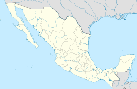

País  México
• Estado: Michoacán de Ocampo • Municipio: Huiramba Ubicación Coordenadas: • Altitud 1 715 msnm Población (2010) 3 307 habitantes[1] Gentilicio Huirambense Huso horario Tiempo del Centro, UTC -6 Código postal 58540Pref. telefónico 438Huiramba es un poblado del municipio homónimo, uno de los 113 municipios que componen al Estado de Michoacán de Ocampo. Según el II conteo de población y vivienda 2010, tiene 12,307 habitantes.
Toponimia
Huiramba (Lugar de palomas), su nombre proviene del purépecha.
Referencias
- ↑ Instituto Nacional de Estadística y Geografía (2010). «Principales resultados por localidad 2010 (ITER)».
Enlaces externos
Categorías:- Localidades de Michoacán
- Toponimia purépecha


Wikimedia foundation. 2010.