Kamarang

Kamarang
Kamarang
Kamarang
Kamarang
Localización de Kamarang
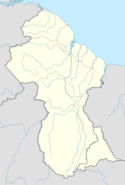
País Bandera de Guyana Guyana
• Región Cuyuni-Mazaruni
Ubicación 5°51′55″N 60°36′51″O / 5.86528, -60.61417Coordenadas: 5°51′55″N 60°36′51″O / 5.86528, -60.61417
• Latitud 5° 51′ 55"N
• Longitud 60° 36′ 51"O
• Altitud 490 msnm
Población
inglés
Huso horario UTC-4
Village 27

Kamarang es una localidad de Guyana en la región Cuyuni-Mazaruni situada en la confluencia de los rios Kamarang y Mazaruni. Su actividad principal es la minería.

Tiene una escuela primaria y una pista de aterrizaje no pavimentada.

Demografía

Según censo de población 2002 contaba con 349 habitantes. L[1]

Dato Funcionarios Profesionales
y técnicos
Clero Comercio y
Servicios
Act. agrícolas Act. industriales Ocup.
elementales
S/D Total
Poblacion 4 5 0 50 4 4 77 77 243
 % 1,71 4,94 3,15 23,51 1,67 5,61 15,88 43,90 100,00

Referencias

  1. Datos del censo 2002. Localidad 27

Wikimedia foundation. 2010.

Игры ⚽ Нужна курсовая?

Mira otros diccionarios:

  • Kamarang — Basisdaten Staat Guyana Region Cuyuni Mazaruni ISO 3166 2 …   Deutsch Wikipedia

  • Kamarang — is an Amerindian and mining village, standing at the confluence of the Kamarang River and Mazaruni River, in the Cuyuni Mazaruni Region of Guyana. Its altitude is 490 metres (1601 feet).Kamarang has a Primary School and a paved airstrip …   Wikipedia

  • Kamarang — Sp Kamarángas Ap Kamarang L mst. ir u. V Gajanoje …   Pasaulio vietovardžiai. Internetinė duomenų bazė

  • KAR — • Kamarang, Guyana internationale Flughafen Kennung [2 nicht mehr vergebenes Autokennzeichen für Kreis Main Spessart in Karlstadt, Bayern . Ersetzt durch MSP …   Acronyms

  • Killi — Pour les articles homonymes, voir Porophyllum ruderale. Nom vernaculaire ou nom normalisé ambigu : Le terme « Killi » s applique en français à plusieurs taxons distincts …   Wikipédia en Français

  • Cuyuni-Mazaruni — (Region 7) is a region of Esequiban Guyana, a territory in dispute by Guyana and Venezuela, bordering the regions of Barima Waini, Essequibo Islands West Demerara and Pomeroon Supenaam to the north, the region of Upper Demerara Berbice to the… …   Wikipedia

  • Mazaruni River — The Mazaruni River is a river in northern Guyana, running from its source in the remote western forests of the Pakaraima Mountains to its confluence with the Cuyuni River near Bartica. As it descends from the Guiana Highlands the river runs south …   Wikipedia

  • Cheddi Jagan International Airport — IATA: GEO – ICAO: SYCJ …   Wikipedia

  • Ogle Airport — (IATA: OGL, ICAO: SYGO) is located on the Atlantic Ocean coast of Guyana, 6 miles east of the capital, Georgetown. In 2003 the airport was a local hub shuttling some 50,000 passengers and 1,800 tons of cargo annually. Construction began that …   Wikipedia

  • Idioma akawayo — Acahuayo, akawaio Hablado en  Venezuela  Guyana …   Wikipedia Español

Compartir el artículo y extractos

Link directo
Do a right-click on the link above
and select “Copy Link”