Kneiff

Kneiff
Kneiff
Kneiff.jpg
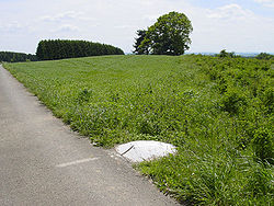
La cumbre del Kneiff
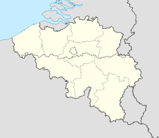
Kneiff
Kneiff
Tipo Colina
Ubicación Troisvierges,
Flag of Luxembourg.svg Luxemburgo
 • Coordenadas 50°09′43″N 6°02′22″E / 50.16194, 6.03944Coordenadas: 50°09′43″N 6°02′22″E / 50.16194, 6.03944
Altitud 560 msnm

Kneiff u Op Kneiff es una colina situada en el municipio de Ëlwen/ Troisvierges, en el norte de Luxemburgo. Con sus 560 metros, es el punto más alto en el país. Es 1 metro más alto que la colina cercana de Buurgplaatz,[1] que a menudo se considera, erróneamente, el punto más alto de Luxemburgo. Está cerca de la ciudad de Wilwerdange.

Referencias

  1. ACT (Administration du Cadastre et de la Topographie) Regional Map R1 Clervaux - Huldange 1:20000 (2003) muestra 'Kneiff' a 560 m y 'Buergplaz' a 559 m.

Wikimedia foundation. 2010.

Игры ⚽ Поможем написать курсовую

Mira otros diccionarios:

  • Kneiff — Le sommet de Kneiff. Géographie Altitude 560 m Massif Massif schisteux rhénan Coordonnées …   Wikipédia en Français

  • Kneiff — is a hill in the commune of Troisvierges, in northern Luxembourg. At 560 metres, it is the highest point in the country; it is 1 m taller than Buurgplaatz [ACT (Administration du Cadastre et de la Topographie) Regional Map R1 Clervaux Huldange… …   Wikipedia

  • Kneiff — Der Hügel Kneiff Der Hügel Kneiff stellt mit 560 m die höchste Erhebung von Luxemburg dar. Er liegt in der Gemeinde Troisvierges (dt.: Ulflingen) auf dem Gebiet der Ortschaft Wilwerdange (dt.: Wilwerdingen), im äußersten Norden des… …   Deutsch Wikipedia

  • Geographie du Luxembourg — Géographie du Luxembourg Géographie du Luxembourg Continent Europe Région Europe de l Ouest Coordonnées 49°45 N, 6°10 E Superficie …   Wikipédia en Français

  • Géographie Du Luxembourg — Continent Europe Région Europe de l Ouest Coordonnées 49°45 N, 6°10 E Superficie …   Wikipédia en Français

  • Géographie du Luxembourg — Continent Europe Région Europe de l Ouest Coordonnées 49°45 N, 6°10 E Superficie 167e rang mondial …   Wikipédia en Français

  • Géographie du luxembourg — Continent Europe Région Europe de l Ouest Coordonnées 49°45 N, 6°10 E Superficie …   Wikipédia en Français

  • Buurgplaatz — (alternate names: Buergplaatz, Burrigplatz, Burgplatz, Buergplaz zu Huldang) is a hill in the commune of Troisvierges, in northern Luxembourg. The 559 metre high summit lies within the Oesling region at coord|50|10|N|6|1|E|type:landmark… …   Wikipedia

  • List of the mosses of Britain and Ireland — This is a list of the mosses of Britain and Ireland:* Abietinella abietina Fir Tamarisk moss * Acaulon muticum Rounded Pygmy moss * Acaulon triquetrum Triangular Pygmy moss * Aloina aloides Common Aloe moss * Aloina ambigua Tall Aloe moss *… …   Wikipedia

  • Extreme points of Luxembourg — This is a list of the extreme points of Luxembourg, the points that are farther north, south, east or west, higher or lower than any other location on the territory of the state.Latitude and longitude*Northernmost point mdash; near Huldange… …   Wikipedia

Compartir el artículo y extractos

Link directo
Do a right-click on the link above
and select “Copy Link”