Lukeville

Lukeville
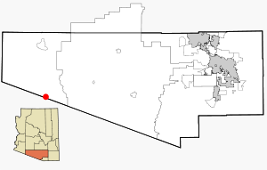
Localización de Lukeville en el Condado de Pima.

Lukeville es una pequeña población fronteriza ubicada en el estado de Arizona, Estados Unidos, ubicada en la Frontera entre Estados Unidos y México, frente a la población mexicana de Sonoita, Sonora. Sus coordenadas son 31°52′54″N 112°48′57″O / 31.88167, -112.81583 y forma parte del Condado de Pima.

La población consiste en el punto fronterizo con Sonoita, una gasolinera, una tienda libre de impuestos y algunos outlets y una terminal de autobuses con salidas hacia Phoenix y Tucson. El pueblo es el punto final de la Carretera estatal 85 de Arizona, que enlaza con la Carretera Federal 8 de México y que lo comunica con Puerto Peñasco.

Lukeville esta localizada enteramente dentro del Monumento Nacional Organ Pipe Cactus.

Véase también


Wikimedia foundation. 2010.

Игры ⚽ Нужно сделать НИР?

Mira otros diccionarios:

  • Lukeville — Lage im County und in Arizona Basisd …   Deutsch Wikipedia

  • Lukeville, Arizona — Lukeville is a small unincorporated border town in southern Pima County, Arizona, United States.The city consists of the international border crossing into Sonoyta, Sonora, Mexico, together with a gas station, a duty free shop, a few outlets that …   Wikipedia

  • 85341 — Lukeville, Az (Miscellaneous » ZIP Codes) …   Abbreviations dictionary

  • National Register of Historic Places listings in Pima County, Arizona — Location of Pima County in Arizona This is a list of the National Register of Historic Places listings in Pima County, Arizona. This is intended to be a complete list of the properties and districts on the National Register of Historic Places in… …   Wikipedia

  • National Register of Historic Places listings in Organ Pipe Cactus National Monument — This is a list of the National Register of Historic Places listings in Organ Pipe Cactus National Monument. This is intended to be a complete list of the properties and districts on the National Register of Historic Places in Organ Pipe Cactus… …   Wikipedia

  • Sonoyta — Infobox Settlement official name = Sonoyta other name = native name = nickname = settlement type = Town motto = imagesize = image caption = flag size = image seal size = image shield = shield size = city logo = citylogo size = mapsize = map… …   Wikipedia

  • Arizona State Route 85 — Infobox road marker state=AZ highway name= name notes= type=state route=85 alternate name= maint=ADOT length mi=128.86 length round=2 length ref=cite web |url=http://tpd.az.gov/data/reports/2006SHSLog.pdf |title=2006 ADOT Highway Log… …   Wikipedia

  • Arizona State Highway 85 — Karte …   Deutsch Wikipedia

  • Arizona State Route 85 — Longueur 207,38 km (128,86 mi) …   Wikipédia en Français

  • Mexican Federal Highway 8 — Federal Highway 8 Carretera Federal 8 Route information Maintained by Board of Highways of the State of Sonora …   Wikipedia

Compartir el artículo y extractos

Link directo
Do a right-click on the link above
and select “Copy Link”