Carrick-a-rede rope bridge
- Carrick-a-rede rope bridge
-
Carrick-a-rede rope bridge

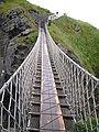
Imagen general del puente
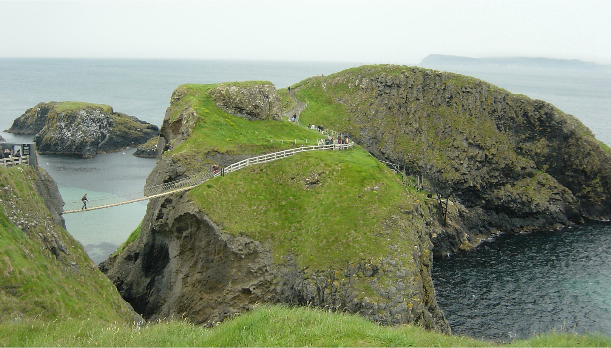
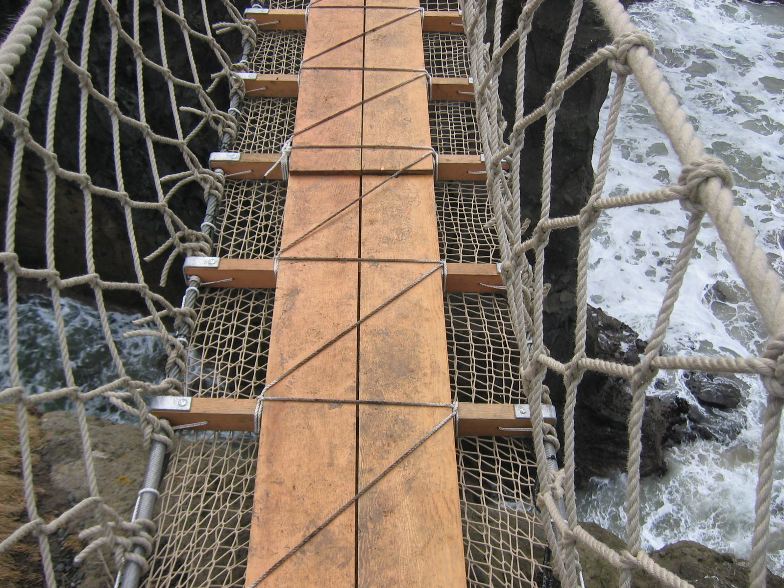
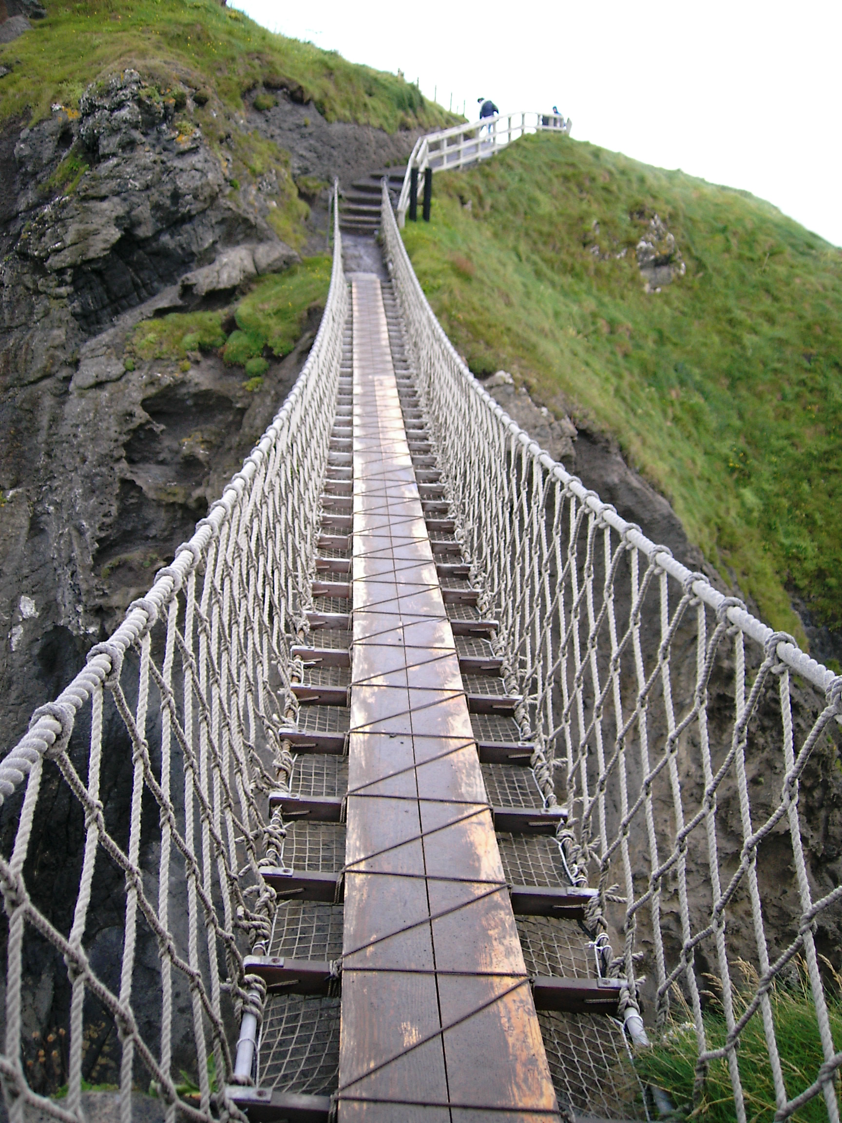
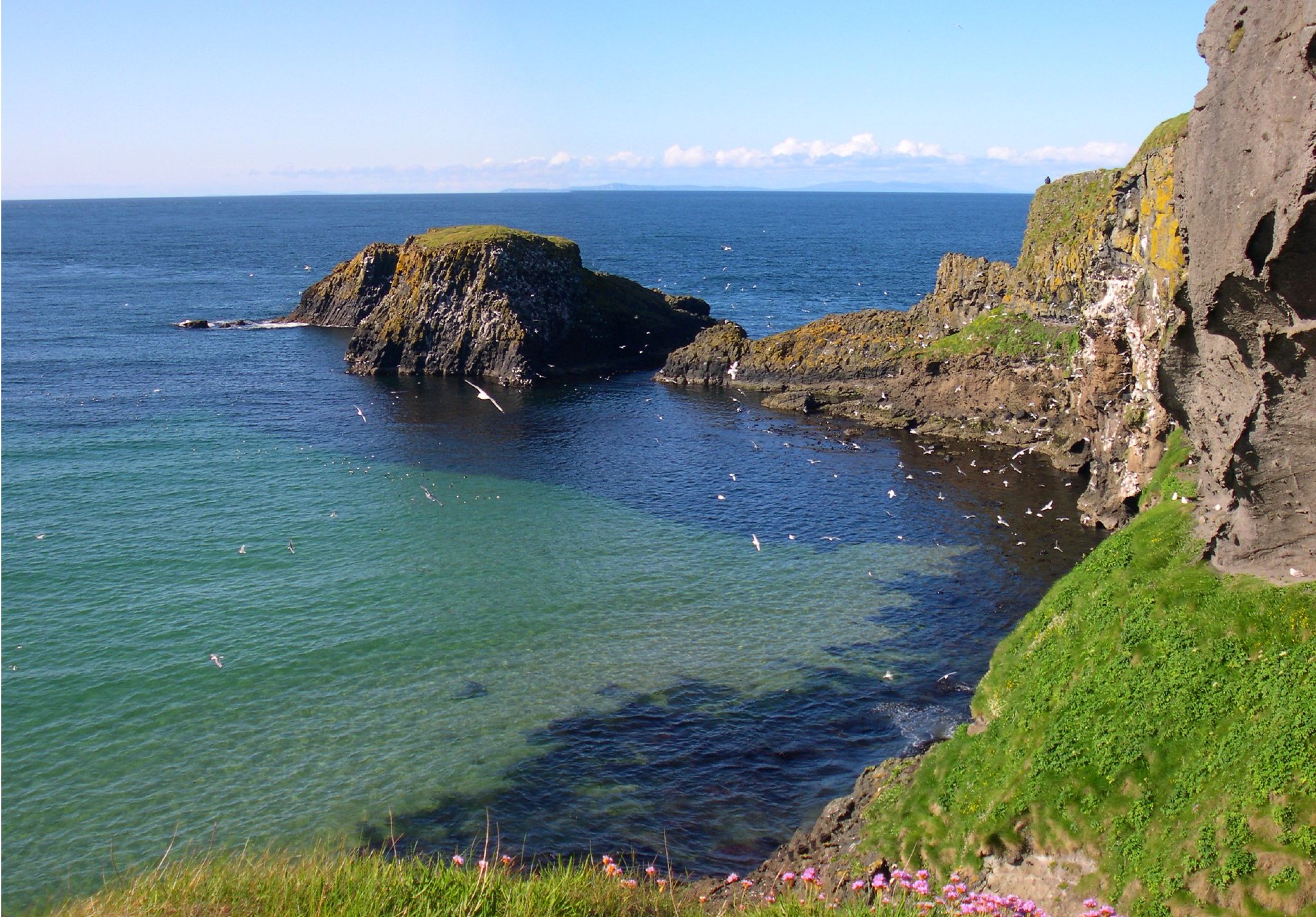
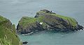
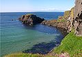
El Carrick-a-rede rope bridge es un puente colgante situado en las cercanías de Ballintoy, condado de Antrim, Irlanda del Norte.
Se trata de un puente situado a una altura de 25 metros sobre el nivel del mar y que une a una pequeña isla, en la que existe una pesquería de salmones, con la costa.
Se ha convertido en una de las atracciones turísticas de Irlanda, así en 2005 tuvo una afluencia de 140.000 visitantes[cita requerida].
Galería
Enlaces externos
Categorías: Atracciones turísticas de Irlanda | Irlanda del Norte | Construcciones del Condado de Antrim
Wikimedia foundation.
2010.
Mira otros diccionarios:
Carrick-a-Rede Rope Bridge — is a rope suspension bridge near, Ballintoy, County Antrim, Northern Ireland. The bridge links the mainland to the tiny Carrick Island. The site is owned and maintained by the National Trust, spans twenty metres and is thirty metres above the… … Wikipedia
Carrick-a-Rede — 55.24032 6.33141 Koordinaten: 55° 14′ N, 6° 20′ W … Deutsch Wikipedia
Inca rope bridge — BridgeTypePix type name = Inca rope bridge image title = Newly reconstructed, the last of its kind sibling names = None descendent names = Simple suspension bridge ancestor names = Rope bridge carries = Pedestrians, livestock span range = Short… … Wikipedia
Liste de ponts du Royaume-Uni — Cette liste de ponts du Royaume Uni recense les ponts les plus remarquables du fait de leurs caractéristiques dimensionnelles ou de leur intérêt architectural ou historique en Angleterre, en Écosse, au Pays de Galles et en Irlande du nord. Les… … Wikipédia en Français
Ballintoy — ( ga. Baile an Tuaigh, lit. townland of the ruler of the tuath ) is a small village in County Antrim, Northern Ireland. It is located alongside the B15 coast road, km to mi|28|spell=Commonwealth north east of Coleraine, km to… … Wikipedia
Northern Ireland — This article is about the country. For other uses, see Northern Ireland (disambiguation). Northern Ireland Tuaisceart Éireann Norlin Airlann … Wikipedia
A2 road (Northern Ireland) — Not to be confused with A2 road (Great Britain). UK road routebox road= A2 length mi= 239 length km= 385 direction= South North start= Newry, County Down. destinations= Warrenpoint Kilkeel Newcastle Strangford Portaferry Donaghadee Bangor… … Wikipedia
Geografía de Irlanda del Norte — Mapa de Irlanda del Norte. Irlanda del Norte se encuentra emplazada en el extremo noreste de la Isla de Irlanda, separada de la isla Gran Bretaña por el canal del norte y el Mar de Irlanda, comprende además otras islas adyacentes. Contenido … Wikipedia Español
Giant's Causeway — For other uses, see Giant s Causeway (disambiguation). Coordinates: 55°14′27″N 6°30′42″W / 55.24083°N 6.51167°W / 55.2 … Wikipedia
Dunluce Castle — Dún Libhse Dunluce Caissle[1] County Antrim, Northern Ireland … Wikipedia


 Wikimedia Commons alberga contenido multimedia sobre Carrick-a-rede rope bridge.Commons